Wayanad: When to visit?
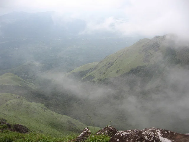
Located on the Western Ghats, Wayanad is blessed with an abundance of natural beauty. If you love rain, the best time to visit Wayanad is from June to Sept, when it gets plenty of rainfall. If not, Oct-May would be a better choice. Temperature during winter (Nov-Feb) period usually gets down to as low as 10 deg C necessitating some thick woollen clothing. In peak summer (May), temperature could reach up to 36 deg C.
With your base camp at The Morning Mist, you can venture to explore the real Wayanad during the day and retreat to your base camp at nightfall. Let us point you to few of the popular attractions (click on the destination for a short description about the location).
| Destination | Distance from TMM | Facilities | GPS Location (Lat, Long) |
|---|---|---|---|
| Kuruva Dweep | 23km / 1 hour | Trekking, Birdwatching, Raft ride | 11.82165, 76.09079 |
| Banasura Sagar Dam | 27km / 45 min | Boating, Fish SPA, Tree swings | 11.67000, 75.95777 |
| Brahmagiri Trekking Point | 37km / 1 hour | Trekking, Birdwatching | 11.937227, 75.962534 |
| Edakkal Caves | 51km / 1 hr 30 min | Trekking, Cave Carvings | 11.616667, 76.216667 |
| Muthanga Wildlife Sanctuary | 58km / 1 hr 45 min | Wildlife Safari | 11.673755, 76.36817 |
| Soochipara Falls | 60km / 1 hr 50 min | Waterfalls, Rock climbing, Trekking | 11.512222, 76.163056 |
| Chembra Peak | 60km / 2 hours | Trekking, Camping | 11.512222, 76.089444 |
| more to come... |
Kuruva Dweep (Kuruva Island)
Kuruva Dweep is a 950 acre protected river delta on the Kabani river. It is situated at a distance of 23km from The Morning Mist, or about 17km from Mananthavady. Rafts operated by the Kerala Tourism Department are used to cross the river to reach the island.
It is among some of the rare places where the nature is preserved in all its glory, being home to rare species of birds, orchids and herbs - all for us to see and appreciate.
Banasura Sagar Dam
Located at a distance of 27km from The Morning Mist, Banasura Sagar is considered to be the largest earth dam in India, and the second largest in Asia.
You can easily spend half a day at this scenic location. Facilities such as boating, fish-SPA, tree-swings, etc are on offer. From the entrance gate, you may walk your way up to the dam site or, you can hire a jeep provided by the facility.
Brahmagiri Trekking Point
Brahmagiri Trek is located 37km from The Morning Mist, about 7km northeast of Thirunelli. It is situated at an altitude of 1,740m above sea level. This trail is home to a wide variety of birdlife. Virgin forests, rivulets and steep hills together offer perfect setting for trekking.
Further information on permits, guides, etc., could be obtained by contacting North Wayanad DFO. There are many well-written accounts on this excellent trek available on the internet.
Edakkal Caves
Edakkal caves is located 51km from The Morning Mist (about 12km away from Sultan Bathery town). The caves are famous for its pictorial carvings from the stone age.
Above the caves one can get a spectacular view of the mountainous junction of the states of Kerala, Tamil Nadu and Karnataka.
Muthanga Wildlife Sanctuary
At a distance of 58km from The Morning Mist, Muthanga Wildlife Sanctuary is contigious to the protected area comprising Nagarhole and Bandipur of Karnataka and Mudumalai of Tamil Nadu. This rich bio-diverse sanctuary is an integral part of the Nilgiri Biosphere Reserve.
Elephants and various species of deers, monkeys and birds inhabit this area along with a great variety of birds and butterflies. Tigers are also sighted occasionally. A drive along the road to Muthanga and further, offers chances to watch these roaming animals.
Soochipara Falls
Also known as the Sentinel Rock Waterfalls, Soochipara Falls is a three-tired waterfall, surrounded by evergreen forests. It is situated in Vellarimala, about 60km from The Morning Mist. The fall height is about 200m with a cliff face that is ideal for rock climbing.
Water from the fall later joins Chulika river, popularly known as Chaliyar river.
Chembra Peak
The towering Chembra Peak is located near Meppadi, about 60km from The Morning Mist. At a height of 2,100 metres above sea-level, Chembra Peak is the tallest peak in the region. Ascending this peak could challenge ones physical endurance.
The climb up the Chembra Peak is an exhilarating experience, as each stage in the climb unfolds great expanses of Wayanad and the view gets wider as one goes up to its summit. The up and down trail would take a full day - so plan accordingly. An unforgettable experience awaits those who are prepared to camp at the top of the peak.


